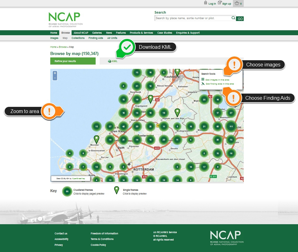
Guide to Searching by Map
The website allows users to zoom into an area of the World before choosing to see the Images or Finding Aids for the area depicted in their viewport.
Online images are clustered at different zoom levels and separate out into individual points as you zoom-in.
Clicking on a point shows a thumbnail of the image, which can be enlarged and zoomed.
Clicking on 'See finding aids in this area' returns a list of index plots, which allow you to find not-yet-digitised photographs of your area of interest.

Need more help? View our short video:
User Guides
Other guides available to help you navigate and use our new website:
Our collections at a glance
- Allied Central Interpretation Unit (ACIU)
- AIRBUS Defence & Space
- BKS Surveys
- Cartographical Surveys
- Defence Geographic Centre (DGC)
- Directorate of Overseas Surveys (DOS)
- German Air Force
- Getmapping
- Joint Air Reconnaissance Intelligence Centre (JARIC)
- Mediterranean Allied Photo Reconnaissance Wing (MAPRW)
- National Archives and Records Administration (NARA)
- Scottish Office Air Photographs Unit (and later bodies)
- Simmons Aerofilms
- UK Perspectives (UKP)

