New batch of images released
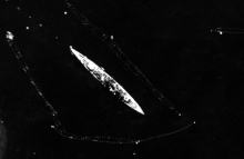
A new batch of over 3,000 historic Second World War aerial images has been released and is now accessible online. Much of the imagery was copied during research for the BBC Operation Crossbow documentary broadcast in 2011 and has now been catalogued and uploaded to the NCAP website.
The imagery adds to our online galleries for Austria, Denmark, France and Germany. It also extends our online coverage into 4 new countries: Bosnia and Herzegovina, Croatia, Hungary and Norway. Two of the newly-uploaded sorties are examined in two new Feature articles covering a heavily bombed railyard near Amiens, France, and German military activity around Trondheim, Norway.
View latest image release in Google Earth


