Lost Nile revealed
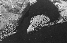
Aerial images of the Nile valley in Egypt in 1934 are now accessible online. Around 400 images show the course of over 170 miles of the river from Aswan to Abu Simbel. This valley was flooded in the 1960's, following construction of the Aswan High Dam. The land depicted in the images now lies under the waters of Lake Nasser.
Following construction of the dam, over 100,000 people were relocated. Many archaeological sites were dismantled and moved to higher ground. These aerial images show a landscape of settlements, fields and forts now lost to view.
26 June 2017


