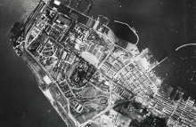
Hong Kong aerial images released
Over 1,600 aerial images of Hong Kong have been released on the NCAP website. Taken in 1924 and 1934, the images are a detailed record of Hong Kong before its rapid expansion in later years.
The aerial photographs were taken by seaplanes operating from HMS Pegasus and HMS Eagle. They were used to assist in the topographic mapping of the territory. Surveyors have annotated many of the photographs with contours, drainage channels and place names.
Our website now shows over 1,900 images of Hong Kong. Website subscribers can zoom-and-pan all of these images, dating from 1924, 1934 and 1964.
12 December 2017


