Coastal Survey images now online
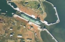
Colour aerial photographs recording the coastline of much of Scotland from 1973-1975 have been digitised and released on the NCAP website. Commissioned by the Scottish Office, and undertaken by Fairey Surveys Limited, the survey collected 4,922 vertical aerial photographs in 50 rolls of film.
The photographs cover the entire east coast of Scotland plus selected areas of the west coast. Taken at periods of low-water to maximise the littoral coverage collected, the Scottish Development Department used the photographs to plan the construction of new facilities for the expanding North Sea oil and gas sector. Potential sites for pipeline landfall, onshore storage and rig construction yards were identified on the photographs for further assessment.
Following the closure of the Air Photographs Unit at the Scottish Office, responsibility for this air survey and image rights transferred to RCAHMS in 1993.
The coastal survey covers the following areas:
- Eastern coastline from Berwick-upon-Tweed to Cape Wrath, including full cover of the city of Edinburgh, plus parts of Orkney and Shetland.
- West coast areas including the Rhins of Galloway, Ayrshire, Firth of Clyde, Arisaig, Lochcarron, Skye, Gairloch, Ullapool and Lewis.


