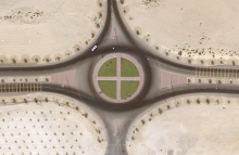
Bahrain aerial images released
Over 270 colour aerial images of locations across Bahrain have been released on the NCAP website. Dating from March 1991, the images show parts of the coastline since reclaimed from the sea, as well as undeveloped areas of the interior now occupied by residential blocks, oil installations and golf courses.
To view the images, click on the links on the right.
2 May 2016


