

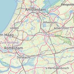
Kerkehout; South Holland; The Netherlands
Subscription required for access to zoomable images


Frame details
Date: 26 February 1945
Location: Kerkehout; South Holland; The Netherlands
Coordinates (lat, lon): 52.104605, 4.380610
Description: This aerial photograph was digitised for the BBC documentary Operation Crossbow.
Location: Kerkehout; South Holland; The Netherlands
Coordinates (lat, lon): 52.104605, 4.380610
Description: This aerial photograph was digitised for the BBC documentary Operation Crossbow.
Image type: Vertical
Scale: 9500
Scale: 9500